Green Indonesia
Indonesia Faces High Frequency of Landslides, Warns BRIN
Over the last decade, Indonesia recorded a total of 7,024 landslide incidents
Minggu, 28 April 2024
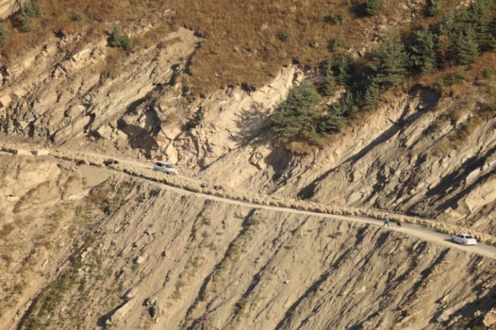
illustration. Indonesia Faces High Frequency of Landslides, Warns BRIN (Pexels/Serg Alesenko)
The National Research and Innovation Agency (BRIN) has issued a warning regarding the notably high frequency of landslides in Indonesia, reporting 183 incidents as of April 2024. According to the National Disaster Management Agency (BNPB), landslides occur more frequently than any other natural disasters in the country, including floods, erosion, tornadoes, and earthquakes.
Data from BNPB over the last decade, spanning 2015 to 2024, recorded a total of 7,024 landslide incidents, highlighting the critical nature of studying natural disasters to minimize future impacts.
"Landslides involve the movement of rock masses, debris, or soil down a slope due to gravity. They are generally isolated processes that are not individually large in size but often occur repeatedly within the same region," stated Sukristiyanti, from BRIN's Center for Geological Disaster Research, on Wednesday (24/4).
She explained that the susceptibility of a location to landslides is determined by geological, topographical, hydrological, and anthropogenic factors, and can be triggered by earthquakes and rainfall. However, developing an early warning system for such geological disasters poses challenges.
To address landslide disasters, Sukristiyanti recommended the use of satellite imagery data utilizing Google Engine and Google Earth Engine platforms. These tools offer high spatial resolution and time-series analysis without cost.
M Rokhis Khomarudin, Acting Head of BRIN's Center for Geoinformatics Research, noted the availability of numerous remote sensing satellites that capture Earth’s surface, which can be extensively utilized by the public.
According to Khomarudin, remote sensing in disaster management can detect changes in land cover, perform hazard mapping, and assess an area's vulnerability to disasters before they occur. "We can monitor the locations and understand the impacts," he explained.
Wartawan : Akshara Abraham
Penulis : Dessy Rosalina


Komentar